


Essentials
Metrics
Select the tab below corresponding to the direction you plan to walk.
Towards Demre:
Towards Kapaklı:


Handy Things to Know
The following notes are gathered from our own experiences and from feedback sent to us by other hikers. Let us know how we can improve these notes – and thanks!
Water
- There are a few water sources but none that we’ve been able to confirm as reliable. There are some cisterns, but most are not clean – highly recommended to boil the water before drinking and/or use filtering and purification tablets.
Highlights
- The excellent Myra ruins are at the Demre side of this section. There are also some related ruins in the hillside above Myra (which the Lycian Way directly passes).
- Not too far off-route at Çayağzı are the Andriake Ruins if you don’t mind a detour (about 1.5 km each way). You could also take a taxi there from Demre.
- In the middle of Demre is the notable Church of St. Nicholas.
Tips
- Take the estimated duration of this section with a grain of salt – due to the length, rocky terrain in parts, and some long, steep slopes everyone will complete this section at different paces.
Route Planning
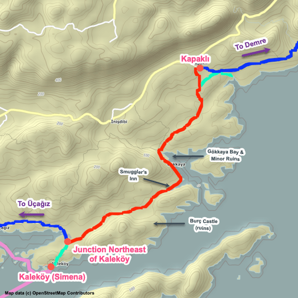
- There’s an alternate path that branches away from this one at a junction to the NW of Çayağzı, goes through that hamlet, passes the Andriake ruins, and follows sometimes-busy roads into Demre. It then passes northward through Demre, including passing the Church of St. Nicholas, before rejoining the main path at the Myra ruins. It’s less appealing overall than this section, but definitely easier and shorter. Many people skip the walk between Çayağzı and Demre and arrange transport for that stretch instead. Based on feedback we’ve received, the alternate path is the more popular option.
- If you are skipping the mountain section between Demre and Finike, the alternate variant (via Çayağzı) is recommended since it will get you into Demre sooner and leave enough time to catch a dolmuş to Finike (or perhaps all the way to Karaöz if you are also skipping the shoreline / greenhouse walk between Finike and Karaöz).
Alerts / Hazards
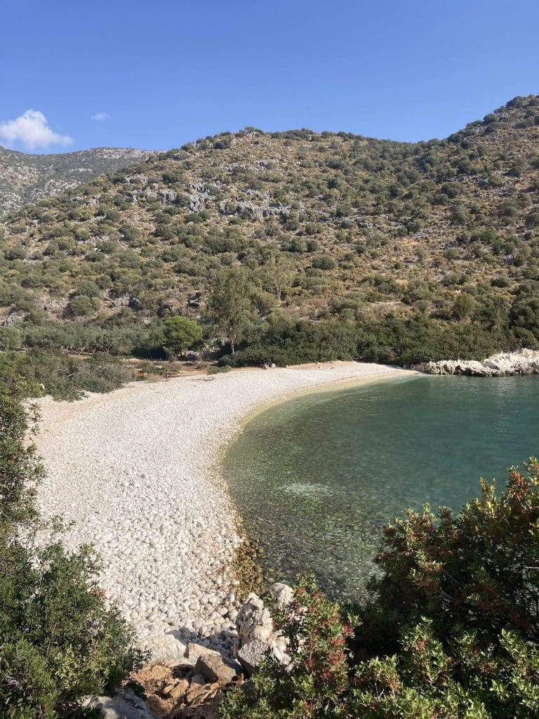
- Between Kapaklı and the junction to the NW of Çayağzı, the rugged path passes Cakil Beach on a trail that runs above the shore. This is mostly rocky, uneven terrain – watch your footing.
- The slope above the Myra ruins is rugged, steep, and often overgrown.
Camping
- We haven’t noticed any particularly good camping spots along this section – if you spot one, please let us know.
Amenities
- There’s a market available directly on-route in Gürses.
Attractions & Highlights
Notable highlights along the trail and at either endpoint include:
Accommodations
Here’s what we’re currently tracking for this trail section:
Wild Camping Locations
Here are the wild camping locations that we’re currently tracking along this trail section:
Water Sources
Here are the water sources that we’re currently tracking along this trail section or at either endpoint:

Pretty Pictures
Sometimes nothing beats a good photo. Or even a bad photo! If you’d like to share some or all of your photo collection with the Trekopedia community, contact us at photos@trekopedia.com and we can arrange a transfer of them. And thanks!
All photos are copyright by their respective owners and are used with permission.

How You Can Help
Trail research is never actually done. Here’s some of what we’re looking for:
✅ More photos! Ideally with geo-location information in the metadata. In addition to using some photos on Trekopedia, we add them to our internal reference database which significantly helps us with trail research. The more photos, the better! If you are willing to share your collection with us, we’d be incredibly grateful. Let us know and we’ll arrange a transfer.
✅ Points of interest. Help us identify (and geo-locate) accommodations, attractions, restaurants, markets, trail waypoints, confusing or problematic junctions, difficult or hazardous places, water sources, and so on.
✅ Tips & recommendations. Share your thoughts with other hikers.
✅ Points of interest. Help us identify (and geo-locate) accommodations, attractions, restaurants, markets, trail waypoints, confusing or problematic junctions, difficult or hazardous places, water sources, and so on.
✅ Tips & recommendations. Share your thoughts with other hikers.
In addition to the above, please see this article for information on more general ways you can help. Thanks!