


Essentials
Metrics
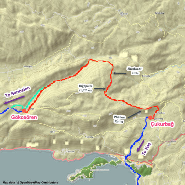
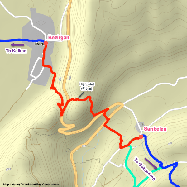
Select the tab below corresponding to the direction you plan to walk.
Towards Gökceören:
Towards Sarıbelen:


Handy Things to Know
The following notes are gathered from our own experiences and from feedback sent to us by other hikers. Let us know how we can improve these notes – and thanks!
Water
- There are some water sources along the section but most of them are unreliable.
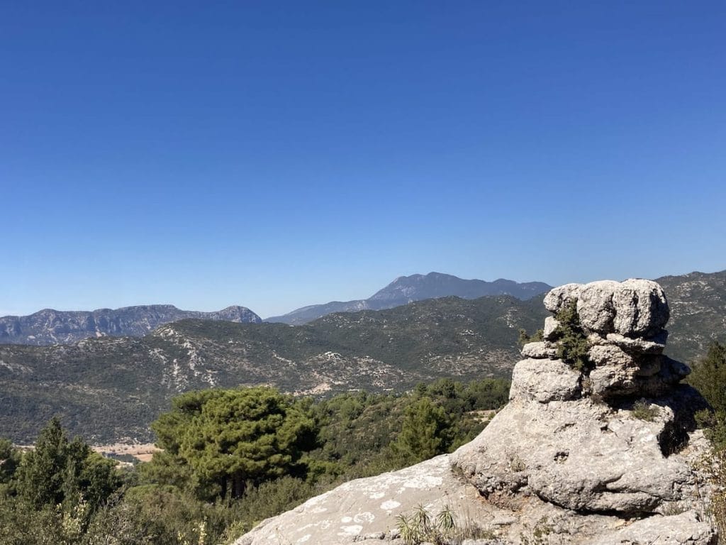
Highlights
- Attractive section with some nice views. Nothing overly dramatic, but peaceful and comforting.
- Farmhouse of the renowned Dağ (Mountain) Hüseyin. He and his family are well-known for their hospitality and support of Lycian Way hikers. Don’t be surprised if they invite you to stop for tea / Ayran or to chat.
Tips
- Very little shade on this section, though given the high altitudes this isn’t as big an issue as it might be closer to sea level.
- The trail between Hüseyin’s Farmhouse and Gökceören (roughly half of this section) has had some excellent maintenance recently, with steps added in places (instead of eroding scree), thorn bushes trimmed, and way-markings improved.
- If you want to take a lunch break in Sarıbelen, one option is to go off-route up the road heading to the NE from the Sarıbelen trailhead. That will take you into the main part of Sarıbelen where there’s a cafe, a market, shaded rest area, etc. If you are OK with hitchhiking, the odds are really good that you can get a ride each way. If you opt to walk it, it’s a little under 1 km each way.
Camping
- Lots of good wild camping locations along this section.
Accommodations
Here’s what we’re currently tracking for this trail section:
Pretty Pictures
Sometimes nothing beats a good photo. Or even a bad photo! If you’d like to share some or all of your photo collection with the Trekopedia community, contact us at photos@trekopedia.com and we can arrange a transfer of them. And thanks!
All photos are copyright by their respective owners and are used with permission.


How You Can Help
Trail research is never actually done. Here’s some of what we’re looking for:
✅ More photos! Ideally with geo-location information in the metadata. In addition to using some photos on Trekopedia, we add them to our internal reference database which significantly helps us with trail research. The more photos, the better! If you are willing to share your collection with us, we’d be incredibly grateful. Let us know and we’ll arrange a transfer.
✅ Points of interest. Help us identify (and geo-locate) accommodations, attractions, restaurants, markets, trail waypoints, confusing or problematic junctions, difficult or hazardous places, water sources, and so on.
✅ Tips & recommendations. Share your thoughts with other hikers.
✅ Points of interest. Help us identify (and geo-locate) accommodations, attractions, restaurants, markets, trail waypoints, confusing or problematic junctions, difficult or hazardous places, water sources, and so on.
✅ Tips & recommendations. Share your thoughts with other hikers.
In addition to the above, please see this article for information on more general ways you can help. Thanks!