

Essentials
Metrics
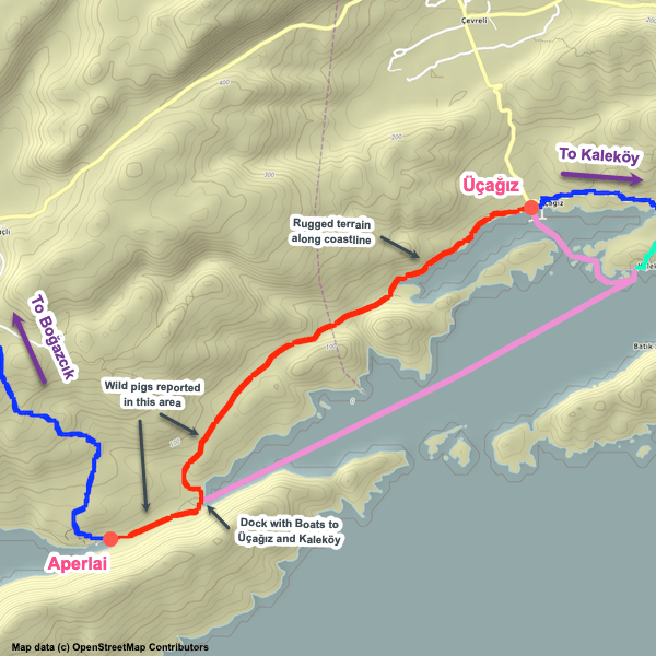
Select the tab below corresponding to the direction you plan to walk.
Towards Üçağız:
Towards Aperlai:


Handy Things to Know
The following notes are gathered from our own experiences and from feedback sent to us by other hikers. Let us know how we can improve these notes – and thanks!
Water
- Very limited water along this stretch, though you can fill up at both endpoints.
- There may be water in cisterns along the way, but expect it to be very dirty.
Highlights
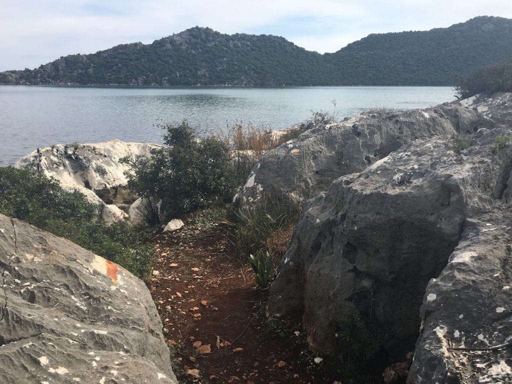
- Very scenic section.
Tips
- There are sometimes lots of thorny bushes along the way (though the trail maintainers often, but not always, have it cleared enough not to affect you too much). Long pants might be worthwhile.
- Allocate a bit more time for this section than you might expect due to the uneven terrain. Our estimate is probably at the low end of the range most people will experience.
Route Planning
- You can usually arrange to take a boat between Aperlai and Üçağız or Kaleköy if you want to skip this section. It is a nice trip that takes about 40 minutes.
Alerts / Hazards
- There’s a bit of scrambling involved in places (mainly towards Üçağız), climbing over and around large boulders. Watch your footing to avoid twisting an ankle or stumbling.
- Wild pigs have been reported in a few places along this section.
Camping
- Wild camping is possible in several nice places, all scenic.
Amenities
- Passes the Aperlai Restaurant (which also has campsites).
Attractions & Highlights
Notable highlights along the trail and at either endpoint include:
Accommodations
Here’s what we’re currently tracking for this trail section:
Wild Camping Locations
Here are the wild camping locations that we’re currently tracking along this trail section:
Water Sources
Here are the water sources that we’re currently tracking along this trail section or at either endpoint:


Pretty Pictures
Sometimes nothing beats a good photo. Or even a bad photo! If you’d like to share some or all of your photo collection with the Trekopedia community, contact us at photos@trekopedia.com and we can arrange a transfer of them. And thanks!
All photos are copyright by their respective owners and are used with permission.


How You Can Help
Trail research is never actually done. Here’s some of what we’re looking for:
✅ More photos! Ideally with geo-location information in the metadata. In addition to using some photos on Trekopedia, we add them to our internal reference database which significantly helps us with trail research. The more photos, the better! If you are willing to share your collection with us, we’d be incredibly grateful. Let us know and we’ll arrange a transfer.
✅ Points of interest. Help us identify (and geo-locate) accommodations, attractions, restaurants, markets, trail waypoints, confusing or problematic junctions, difficult or hazardous places, water sources, and so on.
✅ Tips & recommendations. Share your thoughts with other hikers.
✅ Points of interest. Help us identify (and geo-locate) accommodations, attractions, restaurants, markets, trail waypoints, confusing or problematic junctions, difficult or hazardous places, water sources, and so on.
✅ Tips & recommendations. Share your thoughts with other hikers.
In addition to the above, please see this article for information on more general ways you can help. Thanks!
One hiker reported the following to us: “Had to cross a fairly wide fast-moving stream at one point (about 1 km before Ucagiz). Maybe due to all the rain recently. Was a bit tricky but none of us slipped. Overall was a very nice hike despite the overcast weather.”