


Essentials
Metrics
Select the tab below corresponding to the direction you plan to walk.
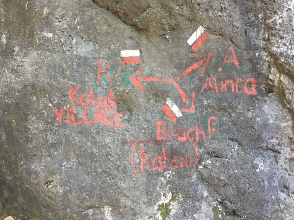
Towards Alınca:
Towards Kabak Beach:


Handy Things to Know
The following notes are gathered from our own experiences and from feedback sent to us by other hikers. Let us know how we can improve these notes – and thanks!
Water
- There’s no reliable water sources long this section. Bring plenty to keep yourself hydrated.
Highlights
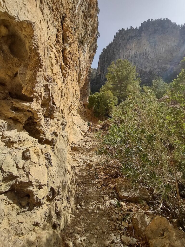
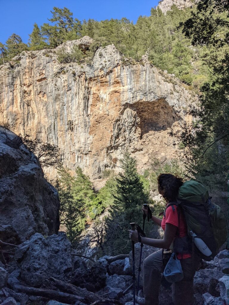
- This is a beautiful, very enjoyable section despite (or perhaps because of) its challenges.
- There’s an optional detour to see an attractive waterfall with shallow pool at its base, partway up the hillside. It’s nothing overwhelming, but does make for a nice break. Wading in the pooled water can be refreshing on hot days.
Route Planning
- In addition to the path connecting Kabak Beach with Alınca there’s also an option linking Kabak’s upper village directly with Alınca. It saves a bit of wear-and-tear on your legs if you have no interest in Kabak Beach. The two options follow the same path for the Alınca half.
- Another, more adventurous, option is to follow some off-route (not part of Lycian Way) trails closer to the coast, via Cennet Koyu (a bay). It’s very nice, but much more challenging.
Camping
- Some very nice wild camping locations offering outstanding views over the coastline.
Amenities
- There’s sometimes a beverage stand available a bit N of Alınca which has an honour-system payment box for whenever it is untended.
Accommodations
Here’s what we’re currently tracking for this trail section:
Wild Camping Locations
Here are the wild camping locations that we’re currently tracking along this trail section:
Water Sources
Here are the water sources that we’re currently tracking along this trail section or at either endpoint:


Pretty Pictures
Sometimes nothing beats a good photo. Or even a bad photo! If you’d like to share some or all of your photo collection with the Trekopedia community, contact us at photos@trekopedia.com and we can arrange a transfer of them. And thanks!
All photos are copyright by their respective owners and are used with permission.


How You Can Help
Trail research is never actually done. Here’s some of what we’re looking for:
✅ More photos! Ideally with geo-location information in the metadata. In addition to using some photos on Trekopedia, we add them to our internal reference database which significantly helps us with trail research. The more photos, the better! If you are willing to share your collection with us, we’d be incredibly grateful. Let us know and we’ll arrange a transfer.
✅ Points of interest. Help us identify (and geo-locate) accommodations, attractions, restaurants, markets, trail waypoints, confusing or problematic junctions, difficult or hazardous places, water sources, and so on.
✅ Tips & recommendations. Share your thoughts with other hikers.
✅ Points of interest. Help us identify (and geo-locate) accommodations, attractions, restaurants, markets, trail waypoints, confusing or problematic junctions, difficult or hazardous places, water sources, and so on.
✅ Tips & recommendations. Share your thoughts with other hikers.
In addition to the above, please see this article for information on more general ways you can help. Thanks!