Alternate Path
Alınca – Dodurga
(via Sidyma ruins)
ID: 
18

Popular variant with some challenging but spectacular portions at the NW end as well as a fair bit of rural road-walking over most of the rest. Passes the intriguing Sidyma ruins upon which Dodurga is built.

Hiker at the Lycian tombs at Sidyma.
Image credit:  
T Roszkowski
, All rights reserved

Essentials

Alınca (village)
Dodorga (village)
NW–SE section with Dodurga to the SE.
This is a ‘down-and-up’ section with a steep slope at the NW end (descending from Alınca towards the S) averaging about 20% but exceeding 30% in parts. S / SE of that, the slope continues to descend towards Dodurga but at a much gentler grade (~9.5%). At the S end the slope rises at a moderate grade towards Dodurga (about 13%) and is roughly flat near Dudurga itself.
Much of the area S of Alınca is along rugged, uneven footpaths that are either cliffside or cut across very steep slopes. The rest of this section is on or alongside quiet rural roads, passing through the hamlets of Avlan and Boğaziçı.
Way-finding is decent in the area to the immediate S of Alınca. However, once the path branches away from the Gey variant way-finding becomes poor with signage rare and sometimes inconsistent.

Metrics

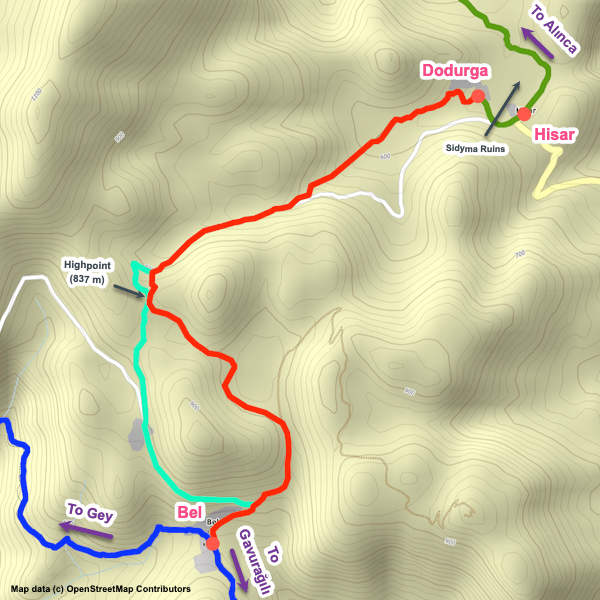
Select the tab below corresponding to the direction you plan to walk.
Towards Dodurga:
Towards Alınca:
10.7 km / 6.6 mi
Distance
475 m / 1,558 ft
Ascent
650 m / 2,133 ft
Descent
~4.6 hrs
Duration
Elevation chart.
10.7 km / 6.6 mi
Distance
650 m / 2,133 ft
Ascent
475 m / 1,558 ft
Descent
~4.6 hrs
Duration
Elevation chart.

Handy Things to Know

The following notes are gathered from our own experiences and from feedback sent to us by other hikers. Let us know how we can improve these notes – and thanks!

Water

  • Limited water fountain options along this section, though you can usually fill up in the villages along the way.

Highlights

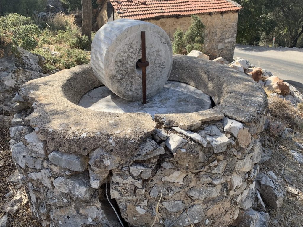
  • The Sidyma ruins are nice, with tombs scattered over a relatively wide area though most are clustered right by the village of Dodurga (indeed, the village is built on the ruins!).

Tips

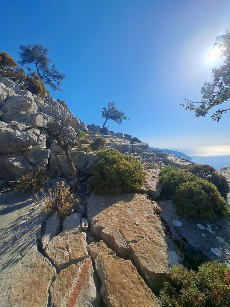
  • This is a very exposed section for most of it. The sun is often a problem during summer – an early start is recommended.

Route Planning

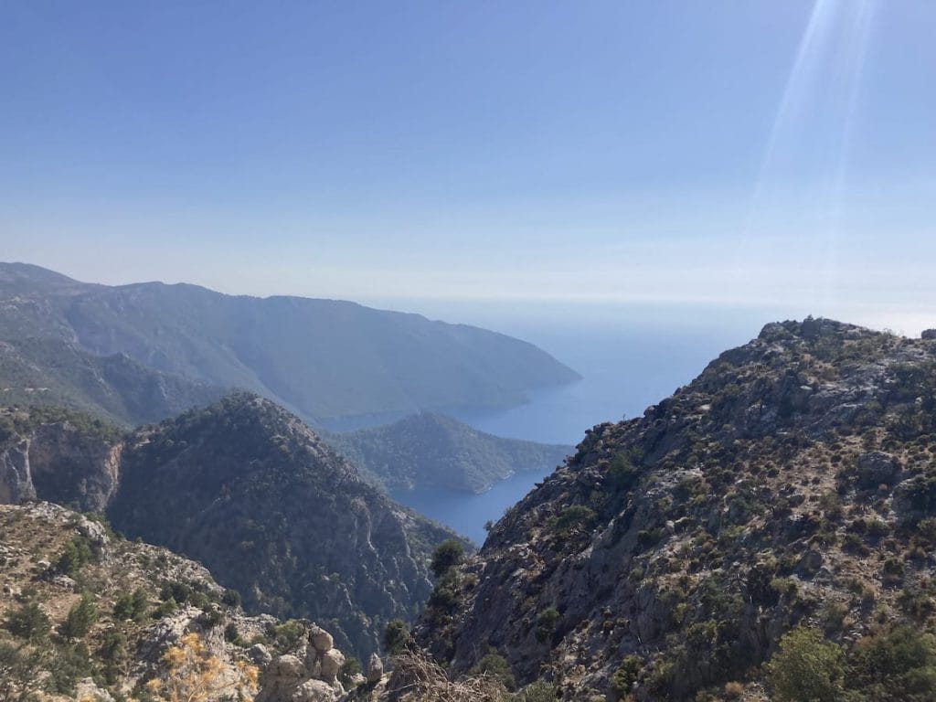
  • This is part of one of the two options between the villages of Alınca and Bel. This one goes via the village of Dodurga and thus takes in the Sidyma ruins. The other option, which is treated as the ‘main’ variant by most people, takes in the village of Gey and is a more remote, rugged option with less road walking and better / more frequent coastal views than this one.

Alerts / Hazards

  • Note that the trails in multiple places to the S of Alınca can be narrow, rocky, and occasionally a bit unnerving (especially if you have a fear of heights) and you’ll need to watch your footing on loose rocks and when maneuvering over / around boulders (especially if you are carrying a heavy backpack).
  • For the portion to the S of Alınca, caution is recommended in poor weather conditions (especially high winds). We suggest following the nearby roads instead in such circumstances.

Accommodations

  • Other than at the endpoints of the section, we’re not aware of any accommodations along the way (nothing in Avlan or Boğaziçı to our knowledge).

Camping

  • There’s a few wild camping options but they are limited.

Amenities

  • Limited amenities at both endpoints (available via the accommodation providers) but none that we are aware of inbetween.

Attractions & Highlights

Notable highlights along the trail and at either endpoint include:
  • Olive Oil Mill in Hisar
    Misc. POI
    Olive Oil Mill
    In Hisar
  • Sidyma Ruins by Dodurga
    Historical Site
    Sidyma Ruins
    At Dodurga

Accommodations

Here’s what we’re currently tracking for this trail section:
  • Annotated map of Bayram’s Place in Alınca
    Bungalows / Commercial Campground
    Bayram’s Place
    In Alınca
  • Annotated map of LeChic Glamping Hotel in Alınca
    Bungalows
    LeChic Glamping Hotel
    In Alınca
  • Annotated map of Likya Guesthouse / Camping in Alınca
    Guesthouse
    Likya Guesthouse / Camping
    In Alınca
  • Annotated map of Türkdomes Glamping Between Alınca & Yediburunlar
    Bungalows
    Türkdomes Glamping
    Between Alınca & Yediburunlar
  • Annotated map of Aynur's Home in Dodurga
    Guesthouse
    Aynur’s Home
    In Dodurga
  • Annotated map of Sidyma Homes in Dodurga
    Guesthouse
    Sidyma Homes
    In Dodurga

Wild Camping Locations

Here are the wild camping locations that we’re currently tracking along this trail section:
  • Campsite immediately southwest of Alınca
    Wild Campsite
    Campsite
    Southwest of Alınca
  • Campsite south of Alınca
    Wild Campsite
    Campsite
    South of Alınca
  • Campsite east of Dodurga
    Wild Campsite
    Campsite
    East of Dodurga

Water Sources

Here are the water sources that we’re currently tracking along this trail section or at either endpoint:
  • Water source south of Alınca
    Water Source
    Cistern
    South of Alınca
  • Map of Ottoman Cistern south of Alınca [172] [CE654]
    Water Source
    Ottoman Cistern
    South of Alınca
  • Water source south of Alınca
    Water Source
    Water Source
    South of Alınca
  • Water source south of Alınca
    Water Source
    Water Source
    South of Alınca
  • Water source between Boğaziçı and Hisar
    Water Source
    Water Source
    Between Boğaziçı and Hisar
  • Fountain in Hisa
    Water Source
    Fountain
    In Hisar

Where to Next?

From Dodurga:

  • Map showing the Lycian Way between Dodurga and Bel.
    Alternate Path
    Dodurga – Bel
    Distance
    5.3 km / 3.3 mi
    Ascent
    305 m / 1,001 ft
    Descent
    205 m / 673 ft
    Est. Duration
    2.25
    Popular alternative connecting the hamlet of Dodurga (which is beside the interesting Sidyma ruins) with the village of Bel.

From Alınca:

  • Map showing the Lycian Way between Kabak and Alınca following the ridge.
    Alternate Path
    Kabak – Alınca
    Distance
    6.4 km / 4.0 mi
    Ascent
    875 m / 2,871 ft
    Descent
    380 m / 1,247 ft
    Est. Duration
    4.0
    Alternative approach linking the ‘upper’ village of Kabak with the village of Alınca following a ridge (sometimes by steep edges).   Beautiful but challenging path with a lot of ascending and descending over rugged terrain. It is shorter and a bit easier than the main variant (which goes via Kabak Beach).
  • Map showing the Lycian Way between Kabak Beach and Alınca.
    Main Path
    Kabak Beach – Alınca
    Distance
    6.0 km / 3.7 mi
    Ascent
    925 m / 3,035 ft
    Descent
    200 m / 656 ft
    Est. Duration
    3.6
    Challenging, beautiful section between Kabak Beach and the village of Alınca that will give your legs and lungs a good workout. There is nothing technically difficult about this section – it is just non-stop climbing or descending.
  • Map showing the Lycian Way between Alınca and Gey.
    Main Path
    Alınca – Yediburunlar (Gey)
    Distance
    7.7 km / 4.8 mi
    Ascent
    460 m / 1,509 ft
    Descent
    560 m / 1,837 ft
    Est. Duration
    3.75
    Challenging but spectacular section between the villages of Alınca and Yediburunlar (Gey).

Pretty Pictures

Sometimes nothing beats a good photo. Or even a bad photo! If you’d like to share some or all of your photo collection with the Trekopedia community, contact us at photos@trekopedia.com and we can arrange a transfer of them. And thanks!
All photos are copyright by their respective owners and are used with permission.
  • View from SW of Alınca.
    Looking towards the SW of Alınca
    Photo by 
    Anna Flack
     – 
    Sept 2022
  • Tombs at the Sidyma ruins.
    Tombs at the Sidyma ruins
    Photo by 
    Anna Flack
     – 
    Sept 2022
  • Hiker at the Lycian tombs at Sidyma.
    Hiker at the Lycian tombs at Sidyma
    Photo by 
    T Roszkowski
     – 
    Spring 2022
  • On trail near Alınca
    On trail near Alınca
    Photo by 
    Darren Moens
     – 
    Fall 2022
  • View down to Cennet Koyu from path south of Alınca
    View down to Cennet Koyu from path south of Alınca
    Photo by 
    Anonymous
     – 
    Fall 2022
  • Olive oil mill at Hisar.
    Olive oil mill at Hisar
    Photo by 
    Rebecca Scheer
     – 
    Fall 2022
  • Sign for Sidyma
    Sign for Sidyma
    Photo by 
    Rebecca Scheer
     – 
    Fall 2022
  • Coastal view from slightly south of Alınca
    Coastal view from slightly south of Alınca
    Photo by 
    Stu Hackett
     – 
    Spring 2016

How You Can Help

Trail research is never actually done. Here’s some of what we’re looking for:
✅   More photos! Ideally with geo-location information in the metadata. In addition to using some photos on Trekopedia, we add them to our internal reference database which significantly helps us with trail research. The more photos, the better! If you are willing to share your collection with us, we’d be incredibly grateful. Let us know and we’ll arrange a transfer.

✅   Points of interest. Help us identify (and geo-locate) accommodations, attractions, restaurants, markets, trail waypoints, confusing or problematic junctions, difficult or hazardous places, water sources, and so on. 

✅   Tips & recommendations. Share your thoughts with other hikers.
In addition to the above, please see this article for information on more general ways you can help. Thanks!
0 0 votes
Article Rating
Subscribe
Notify of
guest
0 Comments
Inline Feedbacks
View all comments
0
Would love your thoughts, please comment.x
()
x