
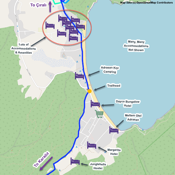
Karaöz

Essentials
Metrics
Select the tab below corresponding to the direction you plan to walk.
Towards Adrasan:
Towards Karaöz:


Handy Things to Know
The following notes are gathered from our own experiences and from feedback sent to us by other hikers. Let us know how we can improve these notes – and thanks!
Water
- There are several water sources on this section though none are confirmed as reliable. For safety you should assume none will be available — bring plenty with you.
Highlights
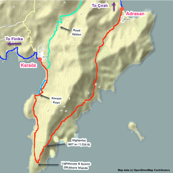
- The views throughout the peninsula are gorgeous, with constantly changing scenery as you go up, down, and around the rugged terrain.
- The iconic islands offshore immediately to the south of the lighthouse are memorable, as is the island of Suluada to the east.
- Korsan Koyu (Pirate’s Bay) is outstanding.
- The rugged coastline is always scenic.
- Dawn and dusk are magnificent at the lighthouse, making it a great place to camp.
Tips
- This section is more challenging than might be apparent from a glance at the elevation chart. While much of the section is comparatively flat, the rugged, rocky terrain for much of the peninsula is constantly changing angle, which can be very wearying (especially on hot days).
Route Planning
- You can bypass this section entirely if necessary by arranging transport via road going via the village of Çavuşköy. We’re not sure if there’s currently dolmuş service but arranging a car is usually easy (talk to your guesthouse operator).
- There’s also an unofficial, off-route path you can follow by foot along quiet roads cutting across the top of the peninsula. This option is included in our GPS tracks.
Alerts / Hazards
- Camping is the only option along this section, so only do this if you have camping gear or are sure you can handle the full distance in one day – certainly doable (most people don’t camp), but keep in mind you’ll have over 1,100 m / 3,500 ft of total ascent and the same in total descent to factor in, over rugged terrain, making this the equivalent to a much longer hike.
- There’s not a lot of shade through much of this section, which can be brutal during the hotter parts of summer.
- On the E side of the peninsula, sometimes downed trees will block the path, necessitating a bit of scrambling.
Camping
- Only limited camping options on the E side of the peninsula due to the terrain and thick woodlands, but there are several excellent spots on the W side as well as at the lighthouse at the southern tip.
Attractions & Highlights
Notable highlights along the trail and at either endpoint include:
Wild Camping Locations
Here are the wild camping locations that we’re currently tracking along this trail section:
Water Sources
Here are the water sources that we’re currently tracking along this trail section or at either endpoint:


Pretty Pictures
Sometimes nothing beats a good photo. Or even a bad photo! If you’d like to share some or all of your photo collection with the Trekopedia community, contact us at photos@trekopedia.com and we can arrange a transfer of them. And thanks!
All photos are copyright by their respective owners and are used with permission.


How You Can Help
Trail research is never actually done. Here’s some of what we’re looking for:
✅ More photos! Ideally with geo-location information in the metadata. In addition to using some photos on Trekopedia, we add them to our internal reference database which significantly helps us with trail research. The more photos, the better! If you are willing to share your collection with us, we’d be incredibly grateful. Let us know and we’ll arrange a transfer.
✅ Points of interest. Help us identify (and geo-locate) accommodations, attractions, restaurants, markets, trail waypoints, confusing or problematic junctions, difficult or hazardous places, water sources, and so on.
✅ Tips & recommendations. Share your thoughts with other hikers.
✅ Points of interest. Help us identify (and geo-locate) accommodations, attractions, restaurants, markets, trail waypoints, confusing or problematic junctions, difficult or hazardous places, water sources, and so on.
✅ Tips & recommendations. Share your thoughts with other hikers.
In addition to the above, please see this article for information on more general ways you can help. Thanks!