Main Path
Adrasan – Çıralı
ID: 
48

Beautiful section between Adrasan and Çıralı traversing Musa Dağı (Mount Moses) and passing through the Olympos ruins.

At Olympos ruins
Image credit:  
Anonymous
, All rights reserved

Essentials

Adrasan (town)
Çıralı (town)
S–N section with Çıralı to the N.
The section mostly consists of climbing (fairly steeply) up, over, and down a single mountain. The southern slope averages about 15.2% though there are several stretches that exceed 20%. The northern slope is steeper, averaging about 16.5% though more notably there are long stretches exceeding 20% (and even 25%).
The southern portion is along rural roads through some farmland with the rest of the way mostly being rugged but good-quality mountain trails through woodlands. North of the Olympos ruins, the path follows rural roads, tracks, a beach path, and paved roads in Çıralı.
Waymarkings are good on the mountain itself but can be confusing for northbound walkers at the final descent into Olympos.

Metrics

Select the tab below corresponding to the direction you plan to walk.
Towards Çıralı:
Towards Adrasan:
15.5 km / 9.6 mi
Distance
910 m / 2,987 ft
Ascent
908 m / 2,980 ft
Descent
~7.0 hrs
Duration
Elevation chart.
15.5 km / 9.6 mi
Distance
908 m / 2,980 ft
Ascent
910 m / 2,987 ft
Descent
~7.0 hrs
Duration
Elevation chart.

Handy Things to Know

The following notes are gathered from our own experiences and from feedback sent to us by other hikers. Let us know how we can improve these notes – and thanks!

Water

  • There’s a water source near the highpoint which seems reliable but as usual with remote stretches on this trail you should carry enough for the entire section.

Highlights

  • The scenery is very nice throughout this section with some excellent views.
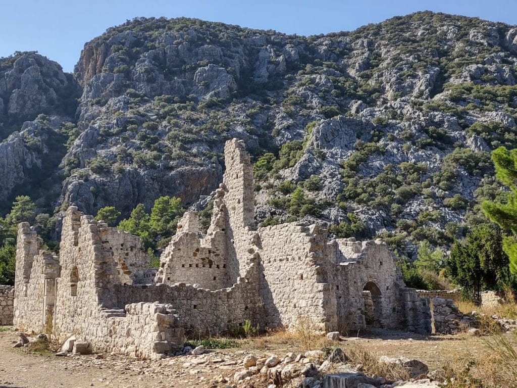
  • The Olympos ruins are extensive and have some notable things to see. Well-worth taking some time to explore them.

Tips

  • There has been some recent re-routing of the path to the immediate S of the Olympos ruins. There is a very easy-to-miss turn at a Y-junction for those walking towards Olympos (no signage or painted blazes, just a cairn someone has erected). If you miss it, you’ll eventually come to a newly-erected fence blocking the old path and be forced to backtrack several hundred metres to the junction. Note, we’ve heard that the fence now has a hole in it, enabling passage again, but we’re not sure if that is going to be permanent.
  • The Lycian Way goes through the Olympos ruins. There’s an admission fee you’ll need to pay, though the old path into the ruins, if not blocked by the fence, bypasses the admission gates (for those coming from Adrasan).

Route Planning

  • As an alternative to this section, you could also go from Adrasan to Olympos via the inland ‘low route’. That option is about 2 km longer, is not waymarked (though is easy to follow), and follows rural roads through the valley the entire way and thus is much, much less steep. The official path is highly recommended, but the alternative road option might be worthwhile in very bad weather conditions. We’ve included this option in our GPS tracks.

Alerts / Hazards

  • At the northern end, just S of the Olympos ruins, there is a short but very steep portion along poor-quality footpaths. This is just after the re-routing mentioned in the Tips section. Be very cautious with your footing, especially in wet conditions – this portion will hopefully be improved by the trail maintainers soon.
  • Can sometimes be quite windy on the mountain. If you are camping up there, make sure your tent is securely pegged down.

Camping

  • Camping spots are plentiful if you plan on overnighting along this section.

Amenities

  • There’s a refreshments stand now available near the highpoint with juices, beer, tea, coffee, etc. The operator also has commercial campsites.

Attractions & Highlights

Notable highlights along the trail and at either endpoint include:
  • Castle Ruins North of Adrasan
    Historical Site
    Castle Ruins
    North of Adrasan
  • Olympos Ruins Between Adrasan & Çıralı
    Historical Site
    Olympos Ruins
    Between Adrasan & Çıralı

Accommodations

Here’s what we’re currently tracking for this trail section:
  • Annotated map of Adrasan.
    Guesthouse
    Meltem Otel Adrasan
    In Adrasan
  • Annotated map of Portakal Bahçesi Bungalov (Orange Garden Bungalows) in Adrasan
    Guesthouse
    Portakal Bahçesi Bungalov (Orange Garden Bungalows)
    In Adrasan
  • Annotated map of No 1281 Boutique Hotel in Adrasan
    Hotel
    No: 1281 Boutique Hotel
    In Adrasan
  • Annotated map of Lykia Edrassa Hotel & Restaurant in Adrasan.
    Hotel
    Lykia Edrassa Hotel & Restaurant
    In Adrasan
  • Adrasan Kıyı Camping in Adrasan
    Commercial Campground
    Adrasan Kıyı Camping
    In Adrasan
  • Adrasan River Hotel in Adrasan
    Hotel
    Adrasan River Hotel
    In Adrasan
  • Annotated map of Otto Palace in Adrasan
    Hotel
    Otto Palace
    In Adrasan
  • Annotated map of Sheriff Olympos Pansiyon at Olympos Ruins
    Guesthouse
    Sheriff Olympos Pansiyon
    At Olympos Ruins
  • Olympos Yakamoz Pension at Olympos Ruins
    Guesthouse
    Olympos Yakamoz Pension
    At Olympos Ruins
  • Annotated map of Bayram Tree Houses at Olympos Ruins
    Guesthouse
    Bayram Tree Houses
    At the Olympos Ruins
  • Annotated map of Olympos Lodge in Çıralı
    Guesthouse
    Olympos Lodge
    In Çıralı
  • Annotated map of Smile Butik Hotel in Çıralı
    Bungalows
    Smile Butik Hotel
    In Çıralı

Wild Camping Locations

Here are the wild camping locations that we’re currently tracking along this trail section:
  • Campsite between Adrasan and Çıralı
    Wild Campsite
    Campsite
    Between Adrasan and Çıralı
  • Campsite Between Adrasan and Çıralı
    Wild Campsite
    Campsite
    Between Adrasan and Çıralı
  • Between Adrasan and Çıralı
    Wild Campsite
    Campsite
    Between Adrasan and Çıralı
  • Campsite Between Adrasan and Çıralı
    Wild Campsite
    Campsite
    Between Adrasan and Çıralı
  • Campsite Between Adrasan and Çıralı
    Wild Campsite
    Campsite
    Between Adrasan and Çıralı
  • Campsite Between Adrasan and Çıralı
    Wild Campsite
    Campsite
    Between Adrasan and Çıralı
  • Campsite Between Adrasan & Olympos Ruins
    Wild Campsite
    Campsite
    Between Adrasan & Olympos Ruins
  • Campsite South of Olympos Ruins
    Wild Campsite
    Campsite
    South of Olympos Ruins

Water Sources

Here are the water sources that we’re currently tracking along this trail section or at either endpoint:
  • Map of Kissing Dolphins Water Fountain in Adrasan [322] [CE769]
    Water Source
    Kissing Dolphins Water Fountain
    In Adrasan
  • Fountain in Adrasan
    Water Source
    Fountain
    In Adrasan
  • Map of Water Tank / Trough between Adrasan & Olympos Ruins [323] [CE779]
    Water Source
    Water Tank / Trough
    Between Adrasan & Olympos Ruins
  • Water Tank / Trough Between Adrasan & Olympos Ruins
    Water Source
    Water Tank / Trough
    Between Adrasan & Olympos Ruins
  • Fountain in Çıralı
    Water Source
    Fountain
    In Çıralı
  • Fountain in Çıralı
    Water Source
    Fountain
    In Çıralı

Where to Next?

From Çıralı:

  • Map of the Lycian Way between Çıralı and Ulupınar.
    Main Path
    Çıralı – Ulupınar
    Distance
    8.1 km / 5.0 mi
    Ascent
    559 m / 1,833 ft
    Descent
    289 m / 947 ft
    Est. Duration
    5.5
    Mountain section, passing the famous ‘burning rocks’ of the Chimaera. There’s an access fee for this zone. There are water falls / streams coming down the mountain that are cold and refreshing.
  • Map of the Lycian Way between Çıralı and Tekirova.
    Alternate Path
    Çıralı – Tekirova
    Distance
    21.8 km / 13.5 mi
    Ascent
    1,140 m / 3,741 ft
    Descent
    1,130 m / 3,708 ft
    Est. Duration
    9.5
    Long but attractive section that is part of the coastal route between Çıralı and Göynük Yayla.   Although this path runs along the coast (much of it via quiet forest roads), there are rugged hills and some steep portions. Has many nice viewpoints.

From Adrasan:

  • Map of the Lycian Way between Karaöz and Adrasan.
    Main Path
    Karaöz – Adrasan
    Distance
    20.4 km / 12.7 mi
    Ascent
    1,196 m / 3.923 ft
    Descent
    1,192 m / 3,911 ft
    Est. Duration
    9.25
    This long, rugged, exhilarating section links the village of Karaöz with the town of Adrasan going via the Gelidonya Lighthouse near the tip of the Gelidonya peninsula. Challenging but beautiful section with fantastic views and constantly changing terrain. This is one of the most memorable portions of the Lycian Way.

Pretty Pictures

Sometimes nothing beats a good photo. Or even a bad photo! If you’d like to share some or all of your photo collection with the Trekopedia community, contact us at photos@trekopedia.com and we can arrange a transfer of them. And thanks!
All photos are copyright by their respective owners and are used with permission.
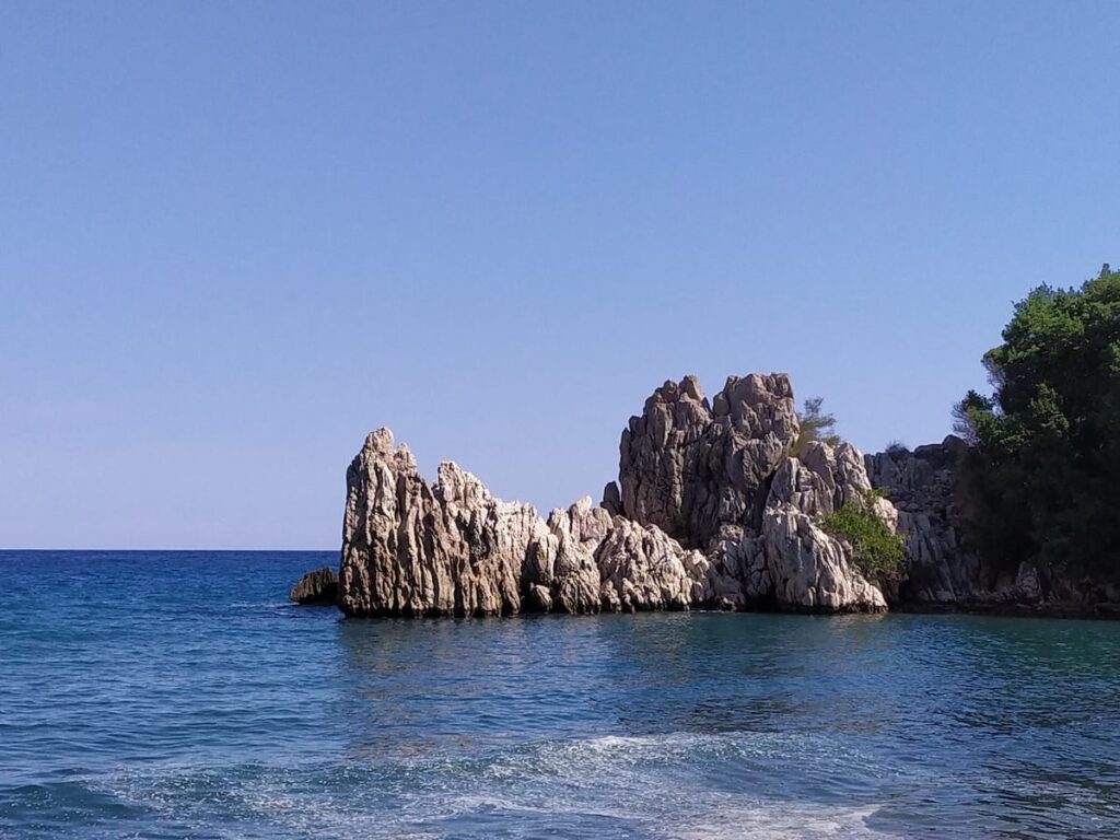
  • Looking along Çıralı beach
    Looking along Çıralı beach
    Photo by 
    Łukasz Ostojski
     – 
    Fall 2021
  • Rock Passage North of Adrasan [206]
    Tunnel passage north of Adrasan
    Photo by 
    Anna Flack
     – 
    Fall 2022
  • Path between Adrasan - Çıralı
    Path between Adrasan – Çıralı
    Photo by 
    Anonymous
     – 
    Fall 2022
  • At Olympos ruins
    At Olympos ruins
    Photo by 
    Anonymous
     – 
    Fall 2022
  • Rocky formations at Olympos Beach
    Rocky formations at Olympos Beach
    Photo by 
    Łukasz Ostojski
     – 
    Fall 2021
  • At Olympos ruins
    At Olympos ruins
    Photo by 
    Anonymous
     – 
    Fall 2022

How You Can Help

Trail research is never actually done. Here’s some of what we’re looking for:
✅   More photos! Ideally with geo-location information in the metadata. In addition to using some photos on Trekopedia, we add them to our internal reference database which significantly helps us with trail research. The more photos, the better! If you are willing to share your collection with us, we’d be incredibly grateful. Let us know and we’ll arrange a transfer.

✅   Points of interest. Help us identify (and geo-locate) accommodations, attractions, restaurants, markets, trail waypoints, confusing or problematic junctions, difficult or hazardous places, water sources, and so on. 

✅   Tips & recommendations. Share your thoughts with other hikers.
In addition to the above, please see this article for information on more general ways you can help. Thanks!
0 0 votes
Article Rating
Subscribe
Notify of
guest
1 Comment
Inline Feedbacks
View all comments
Trekopedia Team
Editor
Trekopedia Team
1 year ago

A hiker tells us: “For the descent to Olympos, we just continued along the old path and went through the hole in the fence. The hole isn’t huge, so you need to be careful to not catch yourself on the fence wire (we removed our backpacks) but it is do-able. Bonus: going through the hole bypasses the admission gate to the ruins.”

1
0
Would love your thoughts, please comment.x
()
x